|
 Rivers Rivers
Estuaries are meeting place of rivers and
sea where river waters are serially diluted with the water
from the seas forming a brackish water zone. Sundarban is
formed in the estuary of Ganga and Brammaputra river forming
the largest detaic system on earth at river mouth. In Indian
part of Sundarbans this estuarine system is called Hooghly-
Matla estuarine system. In his writing the Greek traveller
Ptolemy, refers to five separate estuaries of the river Ganges,
namely the Kambyson, the Mega, the Kamberikhon, the Pseudostomon
and the Antibole. This observation, made in 150 AD, corresponds
very closely to the geographical features evident today. The
main estuaries, from west to east, are the Hooghly, Saptamukhi,
Thakuran, Matla, Bidya, Ajlamari, Bidyadhari, Gosaba, Kalindi,
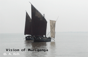
Raimangal. Apart from Hooghly and its branch Muriganga (Bartala)
river, which flows along the east side of Sagar island all
the other rivers have no connections with the head water (fresh
water) channels.
1.) Hooghly river: The name of Bagirathi
(Ganges) after Farakka (here Bhagirathi divided in to Padma
which flows down to Bangladesh and Hooghly which flows down
to the lower Gangetic plains of West Bengal state of India.
It is the main river of West Bengal and form the western most
boundary of South 24 Parganas district and Sundarbans.
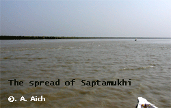
2.) Saptamukhi: The river originates
near Sultanpur and is connected with Muriganga river through
Ghugudanga Gang (Hatania- Duania) and deora canal and falls
to the sea with a very wide mouth after traversing about 80km.
3.) Thakuran: Begins near Jaynagar
in Souh 24 Parganas and has a number of connections with the
saptamukhi.
4.) Matla: It is originated near the
present Canning town by the confluence of three rivers, i.e.
Bidyadhari, Khuratiya and Rampura. Once upon a time it was
the deepest and largest river of Sundarbans and Canning was
an important port, connected with Calcutta canal via Piali,
Bidyadhari and Rampura canal. Now it has lost all its past
glory because of shortage of sweet water drainage from the
upper reaches and silted. Matla now has wide connection with
Bidya and flows to the sea with wide opening.
5.) Bidyadhari: Once upon a time it
was a flourishing branch of Bhagirathi. Now its bed is highly
silted and its connection with Bhagirathi is severed. It now
act as a sewage and excess rain water out let of the city
of Kolkata. It remained active till the end of 15th century
or early 16th century until the diversion of main flow of
Ganga changed its course.
6.) Gosaba: The Gusaba river is formed
by the waters from the numbers of canals from Raimongal and
Matla river. Before reaching the sea it forms numbers of connections
with the Matla proper, especially through Netidhopani.
7.) Raimongal: It originates from
Sahebkhali and reaches the sea. It is connected with Rampuragachi
and Gusaba river by Barakalagachi and Terobankia & Harinbhanga
respectively.
8.) Harinbhanga: It actually demarcates
the Bangladesh and India border and connected with the Jamuna
river through the river Kalindi.
9.) Ichamati: Arises from the river
Churni near Kishengunge flows towards south to reach Sundarbans
after meeting with the river Kadamtali and fall to the sea
as river Malancha. Through this river, Gusaba and Raimongal
get fresh water flow, which is extremely meagre at present.
All these rivers are tidal (two high tide
and two low tide in 24 hours cycle. In every lunar month there
occurs 14 days of spring tide (highest high tide and lowest
low tide in 3 days before and after of full moon and new moon).
The rest of the time there occurs neap tide with moderate
range of exposure and inundation. The average tidal amplitude
in this estuary vary from 3.5 to 5.0 meters with highest in
July-August and lowest in December-January.

|